Tuesday, September 21, 2010

A meeting of Nomads - Alice Springs NT

Alice Springs was the meeting place of a few friends we had made along the track as well as some friends of ours from Nowra, NSW.

Ian and Shirley Salway (from Caravan CoverUp), along with Kerry and Coralie, had arranged to meet us in the Big 4 at the MacDonnell Range Holiday Park, after they came in from the Tanami Track; and we had returned from our trip out to Uluru.   I had rung Ian a few days beforehand to find out when they would be in town, Ian, as usual the joker, teased me with the comment of "we won't have time to stop off at Alice"  I was starting to take the bait, then quickly thought, no, they wouldn't not see us! By the time we returned to the park (from Uluru), they were settled in and had left a message at Reception, with details of which site to find them on; so, as they were out jaunting around we left a message to tell them we were in the park. It was not long after we had finished wetting up and there was a verbal 'knock, knock' outside our awning; Bucko and I raced out to be greeted with huge hugs and  smiles all round; it was SO good to see the 4 of them. 

Ian's working previous life was spent as a 'Truckie' so, and it took no arm twisting to get all of us to go along to see the National Transport Hall of Fame Museum, a Truckie's Heaven; this was also our only chance to sit in a huge Kenworth truck, and we loved the place. 

Evenings meals were spent with each other at the BBQ's with shared salads and many, many laughs.  Note the campground ambience in the photos - yellow lighting to prevent mozzies hanging around, and this type of lighting works.  We felt sad to say goodbye to our good friends, but, they were on their way back to Nowra, NSW, at lest we have good memories of our time in Alice. Thanks Ian, Shirley, Kerry & Coralie. Happy Trails to all of you.    

                              L-R around the table: Shirley, Ian, Mags, Selma-Janet, (in 2nd pic - Bucko) Kerry & Coralie       

       DSC01861

Alice Springs, NT 4 - 10 June, 2010

The MacDonnell Range (Big 4) Caravan Park was to be our 'home' for the next 8 nights before we went to Uluru. Then park was also to be a meeting place for a number of our old and new friends.

The caravan sites in the park are huge, plenty of room for the van, a concrete slab for the annex and green grass (as opposed to dry brown grass or red dirt) for the car, with room besides.  My sister, Mags, was flying in from Tauranga, via, Auckland and Sydney to spend 17 nights with us, so in preparation we set up the full annexe, stretcher bed, table lamp and heater, as this was going to be Mags' bedroom. 

After setting up our van then went looking for fellow travellers (Ashley & Bev), that we met while in Burra.  The four of us had really 'clicked' and had made arrangements to meet up again when we got to Alice; along the track we had kept in touch with each other, so we were looking forward to having a few beers, and many laughs with them.  To give you an example of Ashley's sense of humour, when talking about a dirt road they had travelled, he said 'the corrugations are so deep you need a packed lunch to get out of them"  I love the guy! Bev and Ash were in town for the next 3 days so of course we shared a meal or 2 with them, then off they went; the next time we see them will most likely be in their hometown of Muswellbrook, NSW.

The next few days we became real domestics, cleaned the van, top to toe, washed the clothes, shopped for food, and checked out the town.  On entering Woolworths we felt like kids being let into a lolly (candy) shop, we went crazy, so much FRESH food, crisp lettuces, fruit that was not too ripe,  meat and bread that was not frozen, it was almost heaven! 

Mags arrived on the 9th, looking rather tired after the long trip, leaving Tauranga at 2am the same day and arriving in The Alice at 1pm.  That afternoon was spent settling Mags in then we went for a drive around; I had been to Alice Springs 30yrs before and the town was unrecognisable to me, so we had good time exploring.  IMG_8036The next day we took a trip out to beautiful Trephina Gorge,  in the East MacDonnell Ranges, which has sheer quartzite cliffs and a sandy creek bed, lined with gorgeous River Red Gums. We walked along Trephina, with its wide views and sandy creekbed, to the John Hayes Rock Hole with its steep, narrow rock walls. The rock pool was too cold and deep for us oldies to walk through, however a few young folk were on the other side of the creek, sunbathing on the rocks; they must have been from a warmer climate and were feeling the heat!   Along the way to Trephina we stopped off to have a look at a wonderful old Ghost Gum.  IMG_8019    IMG_8022

Monday, September 20, 2010

Into the Northern Territory - Kulgera Roadhouse, NT (3 June)

After leaving Coober Pedy we had another long trip ahead of us.  Entering the the Northern Territory, we had a sense of excitement; at last we were finally going to see the 'real' outback; our first night in the Territory was spent at the Kulgera Roadhouse.  Not upmarket, but so very 'outback'.  Rugged, and like many of the Stuart Highway roadhouses, it has basic camping grounds, with ablution blocks, fuel and a restaurant.  The food at most roadhouses is usually deep fried, and the coffee is often "help yourself, to the coffee" (after you have paid the required amount, International Roast awaits); needless to say, we cooked our own food, and brewed our own coffee!  Many travellers stay at some of the free camps that line the route, often camping in overnight spots with signs stating 'Road Trains/Trucks only'.  It must be frustrating for the long haul drivers, to pull into a camp spot, only to find heaps of Grey Nomads, with their RVs taking up most of the room!.  What gets to Paul & me is the way some of the 'free-loaders' brag about staying in the Truck Stops. No wonder some of the States are removing the free camping areas.

The good news about Kulgera RH is, it is a step above the others in regards to food, however, we still cooked our own.  The showers, were ok in cleanliness, but the hot water ran out around 7pm, I am just glad we have an ensuite in our van. Most travellers leave their vans hooked up ready for a fast getaway in the morning, and it is not uncommon to be woken around 5am with a van creeping out of the campgrounds.  Bucko and I are never in a hurry, so we are often amongst the last few to take off.

I thought you may like to see a few photos of the trip up the track, from Coober Pedy to Kulgera; notice the long straight red road, the speed limit sign (a change from the SA maximum, of 110), various road signs, a red letter box, red earth and the one I like the best, the Roadhouse sign.

Enjoy.  

Tuesday, September 7, 2010

Woomera and Len Beadell - Australia's last great Explorer

We had to include information on Len Beadell The reason you may ask? During our travels around Coober Pedy, we heard many stories of Len Beadell, a truly remarkable man. Folk who have travelled across and around this vast brown land, have heard of Len, and in particular The Gun Barrel Highway, probably one of Len's most famous/infamous roads, depending  if you have travelled the highway or not!

Len was also the person responsible for selecting the location of Woomera, those of us in our 40s or above will be familiar with the rocket launches that took off from there; even this little Kiwi knew about Woomera!    

For those who may be interested in this wonderful man, why not get yourself an copy of Mark Shephard's book A lifetime in the bush: the biography of Len Beadell. or, go to the link included with Len's name above.

Following is a summary of Len's chronology.

  • 1946 Appointed to find a location for a joint British/Australian government rocket range.
  • 1947 Selects the site of Woomera and the flight path, north-west across the Great Victoria, Gibson and Sandy Deserts.
  • 1948 Surveyed Woomera, and mapped area to the north.
  • 1950 Continued to survey the centreline of the range.
  • 1951 Located and surveyed the 250 mile, 300 mile, 400 mile and 500 mile points along the centreline of the range. Tallaringa Well was located this year. An important Aboriginal waterhole it had not been visited by a white man since Richard Maurice in May 1902. A conservation park has now been proclaimed to protect the area.
  • 1952 Selected the site for atomic bomb tests.
  • 1953 Built access road to the site at Emu, which would become the first section of the Ann Beadell Highway. Later that year he was asked to locate a more accessible site. Maralinga was chosen and named, with access via the Transcontinental Railway.
  • 1954 Prepared contour maps and developed the Maralinga site.
  • 1955 The Gunbarrel Road Construction party was formed. Selected the site for Giles weather station. Originally required to determine the weather for atomic bomb tests, Giles is still operational and is the most remote meteorological station in Australia (25 01' 128 18'E). The Gunbarrel Highway runs from Victory Downs (25 59' 132 58'E) (west of Kulgerra in Northern Territory) to Carnegie Station (25 47' 122 58'E) in Western Australia, which was reached in November 1958.
  • 1956 Work continued on the Gunbarrel Highway. Beadell began reconnaissance of a road from Mount Davies on the Gunbarrel across the Great Victoria Desert to Emu on the Ann Beadell Highway. Sites for mobile meteorological stations were selected at Mount Lindsay in the Birksgate Range (27 01' 129 53'E) and Coffin Hill (27 31' 130 28'E).
  • 1957 Work continued around Giles Weather Station, the Mount Davies Road, and Anne Beadell Highway.
  • 1958 Gunbarrel Highway completed.
  • 1959 Continued survey work at Maralinga. Took five months off on an around the world trip.
  • 1960 Surveyed and constructed Sandy Blight Junction Road from east of Giles, north to Mount Leisler (23 19' 129 21' E), where he re-located a tree blazed by William Tietkens in May 1889.  From here he directed a road east to Mount Liebeg (23 16' 131 16' E), and also to the west (Gary Junction Road).
  • 1961 Kintore Avenue was constructed. This short section linked the Gunbarrel Highway with the Mount Davies road - named after nearby Mount Kintore (26 33' 130 29' E). Another section of the Anne Beadell Highway was constructed from Anne's Corner to Voakes Hill (28 29' 130 34' E). From Voakes Hill he constructed a road south to Cook on the Transcontinental railway.
  • 1962 Anne Beadell Highway was continued west from Voakes Hill to the Western Australia border. With his wife Anne and baby daughter Connie, Beadell reconnoitred a road south from Warburton (26 13' 126 39' E) across the Great Victoria Desert. At what would become the Neale Junction he turned east to link up with the construction party. Later that year he reconnoitred the road south from the Neale Junction to the railway line at Rawlinna. This became the Connie Sue Highway. Anne Beadell Highway was pushed west to Yeo Lake (27 58' 124 21' E). The Anne Beadell Highway now ran over 1065 kilometres from Mabel Creek, near the Alice Spring's railway line, to Yeo Lake in Western Australia. It had taken nearly ten years to complete.
  • 1963 The Gary Highway from Everard Junction on the Gunbarrel Highway was pushed north to Gary Junction (22 30' 125 15' E) near the Canning Stock Route. The Gary Junction Road was built across the Great Sandy Desert to Callawa Station (20 37' 120 30' E).

Monday, September 6, 2010

Coober Pedy - Mad Max country - SA (28 May - 3 June 2010)

After leaving Woomera we continued on up the middle, next stop was Coober Pedy, where the Mel Gibson movies, of Mad Max were filmed.  Coober Pedy is famous for the wonderful colourful opal mined here, as well as for under ground homes and Churches.  The trip from Woomera to Coober Pedy is the longest stretch on the Stuart Highway without fuel stations.  A lesson was learned on this stretch - always top up with petrol when one has the opportunity!   We speak from experience; about 80kms out from Coober Pedy we noticed the fuel gauge was getting rather low, so slowly, slowly, the speedo started to descend, until we limped into the town (along with 6 other vehicles) and made a bee-line for the first petrol station.  A very strong head-wind played havoc with our fuel consumption, and as it turned out, we had 30 litres to spare.  Never again have we gone past a petrol station without topping up! The locals must have a laugh to see all the different vehicles limping into town.
When in the caravan park at Coober Pedy, I mentioned to a lady we were staying 5 days, talk about shock, horror, the response to my comment was,  "Five days in Coober Pedy, what is there to do?"  I am sure you will be able to see from our list below, there is more than enough to do for many days stay in Coober Pedy. We had a great time, and Bucko had a delicious 'Coat of Arms' pizza in the best food shop in town, 'Johhnos', spotlessly clean, incuding the front and back counter space, along with great service, food and coffee.  Coober Pedy is a very unusual town, the streets are dry and dusty, nearly all the front yards look like garbage dumps, took me a while to figure out why - doh!  No backyards to hide the unwanted cars, tyres, pipes and the general rubbish in, so, of course they all sit out the front.  General decorations around the town are old used tyres; they are used as retaining walls, garden beds, you name, the folk of Coober Pedy have come up with a way to recycle the tyres.  All in all, we enjoyed are time in this rustic town very much, a few photos from around the town are in the album below.
After a look around town and the usual visit to the Information Centre, we decided to extend our stay from 3 to 5 nights, there was so much we wanted to do! Amongst the list was:
  • Take a 4hr flight to view Lake Eyre, with water in it, and stop over for lunch at William Creek, an iconic Outback Pub, which was once a stop on the old Ghan Railway line, total population 6!  Fantastic food, prepared by the lady who started the "Road Kill" menu at Parachilna in the Flinders Ranges. 
  • Ride with the Postman (and 12 others), on the 12hr mail run to out back stations. Lunch was at William Creek, we were almost locals, 2 days in a row we had been there for lunch.  Dinner was at the Pink Roadhouse at Oodnadatta.  Stations we stopped at along the way included Anna Creek, at 34,000sq kms the largest in the world - and the size of Belgium!  The photo album includes a photo of the mailman, who is an very interesting man, we learnt heaps, about the area and the brave explorers who ventured into the outback.  A special stop for myself and Bucko, (we both adore anything to do with Trains), was at the old iron railway bridge; which was part of the old Ghan rail track.  The powers that be, decided to pull down the bridge, however, the locals kicked up a bit of a ruckus and the bridge still stands. No welding was used in the bridge, only steel rivets, and the bridge has withstood many very high floods, as high at the railway lines, running through it.  More info: Mailrun Tour
  • Visit Underground Churches and Fays House. Our pick of the churches is the Serbian Church, a true underground church. On opening the door, one has to walk down and down a cool corridor, with walls of sealed stone, to then turn left into the main chamber of the church.  Unfortunately, due to cost savings some of the lights were not working, so the wonderful painted windows did not show up well in the photos I took; still we liked the place.  Fays' house, is like time has stood still and we had stepped back into the 60s.  A condition of sale, when Fay sold up, was for the house to be kept as a living museum, and it is, a lovely cool house to live in.  On those extra hot days that they get in Coober Pedy, a swimming pool is just outside the underground house, clean and ready for a quick dip, all under the cover of a roof and with shade cloth walls.  Ah, the best of both worlds. 
  • Visit the Old Timers Mine, this is an old abandoned mine which was accidently  discovered when the owners decide to dig out another room, for one of their children.  Instead of digging into solid rock, suddenly a hole appeared, and there was the old mine, just as the old miners had left it, many years ago.  The good news for the new owners was, the wall they broke through actually had a good seam of opal in it. I would not have liked to have been a miner in the old days, scary stuff in those terrible cramped and dusty conditions, see the 'models' below!. Come to think of it, not much different nowadays - thinking of those miners in Sth America.  More Info: Old Timers Mine  
                                  IMG_7313          IMG_7314
  • Tour a working Opal mine, now, this was very interesting, the young women who showed us around worked in partnership with her Dad; her young son, was scampering around the mine, just like any child would do in their own back yard!  A demonstration was given on how to make the explosives, used to break up the rock - they look just like a giant firecracker.  A sad tale we were told was, when a friend of the young women turned 21yrs, there was a party up above one of the mines.  The Birthday boy went down to set up a 21 bang salute, then came back up to view the fireworks, oops, the last one did not go off, so back down the mine he went to see what had happened..... a complete NO, NO, the poor lad was killed when the explosive went off.  Talking about dust, the demonstration given to us, was all done with the miner in a very confined space, drilling with the jack hammer, type of machinery and with NO mask.  All the folk on the tour gasped, and asked about masks, the response was"yeah, I am meant to wear one, but, they get too hot etc etc."  All I could think of of was how her lungs could be sucking in all that damaging dust.  Us city folk are so conscious of work safety, and out in some of the bush areas it seems it is all to hard.     
                   IMG_7870      IMG_7871 
  • Visit The Breakaways, most people who come to Coober Pedy do so, to see the opal mines, a few dugouts and usually only stay a night or two.  What a wonderful landscape they are missing out on, The Breakaways.  See for yourself.                                                          IMG_7740              IMG_7741 
  • Take a trip to the Dog Fence, a fence of legend, which is really just a fence, but, we had to see it.  For my  international readers, you may be asking, "What is the Dog Fence?  "The Dog Fence is a pest-exclusion fence that was built in Australia during the 1880s and finished in 1885, to keep dingoes out of the relatively fertile south-east part of the continent (where they had largely been exterminated) and protect the sheep flocks of southern Queensland. It is one of the longest structures in the world and is the world's longest fence. It stretches 5,614 km (3,488 mi). (Ref: Wikipedia). The only native dog in Australia is the Dingo, who just loves to hunt sheep.
                             IMG_7723        IMG_7721
  • Purchase a book 'The Last of The Nomads' which is about Warri and Yatungka who were believed to be the last members of the LASTNOMADSMandildjara tribe, of the desert nomads to live permanently in the traditional way. This book is a real eye-opener on how strong and resilient the Aboriginal people were, to be able to live and survive for thousands of years in such a hostile and harsh land.  Do yourself a favour and borrow the book from your local library, or better still, purchase it for yourself, this book is a 'keeper.'  To purchase follow this link The Last of The Nomads.
I hope you enjoy reading this posting; why not leave us a comment, go on, be brave, it is so easy to do. Just click on the word Comment and follow the instructions.  Don't forget to sign your name to the comment, so Paul & I know who you are. (smile)

Up the middle, on the Stuart Highway - Woomera - SA (27 May 2010)

After our wonderful adventure in The Flinders Ranges, it was back down to Port Augusta for a couple more nights, to stock up on groceries and do the washing, before we set off up 'The Middle'.
We left Port Augusta on the 27th of May.  To begin with the weather was dull and grey, and we felt a tad sad to be leaving views of the Flinders Ranges behind us; about 15mins out of the town, the rain came bucketing down, all smack bang into our windscreen.  It was rather difficult to see at times, and we were just glad we did not meet up with any Road Trains going down to Port Augusta. The rains topped and then a very strong headwind took over!
Woomera, was a stop over on our way to Coober Pedy; Paul & I had wanted to stay here so we could look at the old rockets used on the Woomera Rocket Range.  The camp ground is vey small, with clean pre-fabricated ablution blocks.  The lady on reception was friendly and gave us a map to the town and the sites.  As soon as we had settled in, we did our usual and took off for a drive around town, this did not take very long! I could feel spirits of old about the place, and the town seems to have a sad are about it.  The supermarket was HUGE with very wide aisles between each section, a left over from the days when the town was full to capacity, with Defence Department personnel, who worked on the rocket range. The Defence Department still maintain a small presence in the town, which most likely keeps it going.  The rockets intrigued us, so here are a few pics to share with all those who are old enough to conjure up visions of rockets, when ever Woomera is mentioned!  Enjoy.
To see the photographs, click on the link - View Full Album

Sunday, August 1, 2010

Flinders Ranges - SA (12 - 26 May 2010)

Port Augusta : Our trip from Burra to The Flinders Ranges was via Port Augusta, at the head of the Spencer Gulf in SA.  Port Augusta is where five roads converge, (commonly known as The Five Ways), West to Perth, North to Darwin, North-East to Broken Hill and New South Wales, South-East to Adelaide and Melbourne, and South-West to the Eyre Peninsula, SA.  Port Augusta is a seaport with a natural harbour, which was settled on 24 May 1852 by Alexander Elder and John Grainger. The port was named after Augusta Sophia, Lady Young, the wife of the Governor of South Australia, Sir Henry Edward Fox Young. A railway junction city, Port Augusta is a stop on the Indian Pacific trans-continental train service on the Sydney–Perth railway and on the Ghan service between Adelaide, Alice Springs and Darwin.  Most travellers use Port Augusta as a stop-over enroute to other parts of Australia, a quick shop to stock up on food items, do the washing in water other than brown bore water, then on their way again.  Bucko and I were no different, we did however visit the Wadlata Outback Centre, attached to the Information Centre, which provided us with an introduction to life in the Australian outback.  The Wadlata Outback Centre is well worth a visit. Ref: Wadlata Outback Centre and Port Augusta Council

Rawnsley Park Station : We had booked to stay at the caravan park at Rawnsley Park Station (RPS) for 3 nights, however, in the end we extended our stay to 11 nights.  There is so much to see in The Flinders Ranges, including WiIpena Pound, a natural rock formation resulting from millions of years of erosion, and many picturesque and ancient Gorges.  Rawnsley Park is in an isolated part of the Flinders Ranges, and as such has only satellite communications (Phone, TV and Internet) to the rest of the world including Australia.  The high walls of Wilpena Pound blocked standard communications from getting into the Park, and surrounding areas, hence the reason for many folk driving to The Pound to make mobile calls, or to use their lap-tops.  Bucko and I were amongst those people, we made a few calls out to family and friends when we where up visiting The Pound.
From RPS we were out and about nearly every day, of course it did rain the day we arrived and the day we left, we are The Rainmakers after all! Listed below are some of the many wonderful sights etc, that we saw in our travels around The Flinders.IMG_1626

a plane flight from RPS took us over Wilpena Pound, and the Ranges, a beautiful sight. A hazy start to the day soon cleared, and we were able to see the Ranges in a soft golden light. 

Glass Gorge, I drove off road, along an ancient and rugged river bed, through stunning Glass Gorge, where (while I was driving), we spotted a rare Red Footed Wallaby, who scampered off, up the side of the road before I could get a photo.  IMG_6486I was however able to take a picture of a Grey Wallaby, this creature was not shy at all, and did not even move as the car crept slowly along beside her, and her Joey. The track to Glass Gorge runs north from Blinman and is  the original route for drays delivering copper to the railway at Parachilna, it is a pretty rugged road, so I would not like to have been a bullock driver in those days!

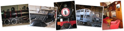
Parachilna Road House with it's menu of 'Road Kill' - Kangaroo, Emu etc was a very interesting place, the roadhouse 'sits' right beside the railway and with overflow accommodation (from the Hotel), in old Shipping Containers'.  If we had stayed until the evening,  we would have been able to sit on a bench outside the pub, to watch the coal train returning from Leigh Creek (in the North), roll on by on its way to the power station at Port Augusta. The train consists of some 180 trucks, 3 km in length, and takes about 5 minutes to pass.

A walk into Wilpena Pound, took us to where the original station farmhouse, which belonged to the Hill Family, still stands; along with a few items used on the station.  The walk in is along boardwalks (which are over the river), and rough paths, along the way we came across a few Wallabies just doing their thing, they didn't even look at us humans!  There is now a Heritage Protection on the area surrounding the old house. 
The Hills Homestead (12)    Sliding Rock Wilpena Pound (1)      
A steep rocky climb behind the house, took us to a platform from where we could view the Pound, which appears to be a real oasis.  The river runs into the Pound, but looks can be deceiving, the place was no good for  farming, too dry, and then floods would come and wash away the pathway into the Pound, making it far too difficult to take goods in and out. In the end the family went back to Adelaide and gave up the farm.  The path was cut out by the family themselves, and it is not until we saw it with our own eyes, that we appreciated what a hard life the early famers had. The photo above is of Sliding Rock, which sits almost (in this section) on a very narrow path into the Pound. 

Arkaroo Rock , an important Aboriginal art site in the Flinders Ranges features ochre and charcoal images depicting the creation of Wilpena Pound.  The circuit walk to the cave drawings was so beautiful, a bit rocky, but well worth the climb. We met a friendly traveller, on his way back down, who advised us to "take the path to the left when you get to the fork in the road, as it was much easier to climb".  Good advice.    IMG_6585     IMG_6597     
IMG_6615
The trip back down was much rockier, and the view more spectacular than the path upwards; at times we felt we could almost reach out and touch to huge rocky outcrops to our right.

Sacred Canyon, a small chasm where ancient Aboriginal rock engravings are found on sandsIMG_6731tone walls, however the carvings were very hard to photograph, so we took none.  At the end of the chasm was a very high rock wall, with a THIN ledge, Bucko climbed the wall, then came back to tell me "if you don't come come up here, you will be disappointed, there is a massive OLD River Red Gum, which I know you will like to see."  So, up I climbed.  It was worth it. Bucko stood inside the burnt out trunk of the, still surviving tree, just to give a bit of perspective of how high this tree is.  The return trip back to our car, was rather scary for me as I started to slide off the edge of ledge!!! Thank goodness, my hero was there to save me.      IMG_6627

The  Cazneaux Tree, This magnificent River Red Gum  was photographed by a renowned Sydney photographer, Harold Cazneaux in 1937. The photograph, titled 'Spirit of Endurance', gained international recognition. The tree is about 700 years old and is still sprouting new branches; fire, drought and floods seem to not impact on the wonderful River Red Gums. 


Old Wilpena Station, lies within the park only a few kilometres from the Wilpena Pound Resort. An important pioneering pastoral run, Wilpena Station was established in 1851 and had a working life of 135 years, before it slipped into retirement. The station finally ceased operations in 1985 when the Hunt family's (they were the last pastoral lessees) lease expired. It was purchased by the government and in 1988 dedicated as an addition to the park. Today the Old Wilpena Station Historic Precinct is one of South Australia's most significant pastoral settlement sites due to its fine condition, wealth of heritage and spectacular setting. Preserved at Old Wilpena Station is the most complete group of early station buildings surviving in South Australia in an authentic pastoral landscape. It was interesting walking around this old station, the sight that took our eye was the tree with the fence posts in it? The posts have been there for over 100 yrs!     
IMG_6878
Bunyeroo Valley and Gorge, a very scenic drive through the valley with views of the impressive Razorback Ridge, with various lookouts along the way. IMG_6668At the end of the valley, after passing the old stockyards of Yanyanna, which was the central point in the Aroona pastoral run, we then followed the creek bed to pass through Bunyeroo Gorge.  It had rained a few days before we took this drive and water was in the creek, a bit of mud sliding took place, but we handled it ok, I am glad to say, Bucko was driving.  The photo  to the right is of the ABC Range, taken from the lookout, before we went down in to Bunyeroo Valley. The road was dirt all the way and from other campers we had heard it was a tad scary when they drove through, after the rain a few days before!

Brachina Gorge is one of the park's most popular and spectacular tourist attractions. The gorge is an important refuge for the Yellow-footed Rock-wallaby as well as many species of birds and reptiles. The Brachina Gorge Geological Tour is a 20 km self-guided trail that passes through 130 million years of earth history. This gorge just blew us away!  Along the drive are signs detailing how old the rocks are in each particular section, how they were formed and what they consist of.  We felt like time travellers, it certainly puts things into perspective, we are on this earth for only a mini second! Ref: Flinders Ranges National Park    IMG_6677 
  IMG_6675


Arkaroola Wilderness Sanctuary : While at Rawnsley Park we decide to leave our van and drive the Land Cruiser up to Arkaroola for the night; we had booked a basic motel room, and it was very basic, ratty edged towels and freezing cold room, with no heating! Oh well, we did want a rustic experience and we got it!  The reason for us going to Arkaroola was to take the very much talked about, Ridge Top Tour. The trip to Arkaroola took us the better part of a day, with a bitumen road to just before Blinman, then it was dirt the rest of the way.  I had decided to drive, so off we set, cruising along the road in the early morning sun, until we came over a hill. EEEK!! A huge Red 'roo came bounding diagonally across the road, in front of our car!  Fortunately I had not been driving fast, and I was proud of myself, I very slowly and calmly put the brakes on and slowed down, the 'roo bounced off onto the grass and kept on going.  Just that morning, I had  commented to Bucko, "we have seen all the animals (for the Flinders), which are listed in the brochure, except for the Red Roo."  Well, I got my wish, scared the heck out of me!  The Ridge Top Tour was simply the BEST, very, very rugged and only for experienced 4WDrivers, at times we seemed to be teetering on the edge of the cliffs!  All extremely exciting, and exhilarating, we LOVED it. Although we only travelled 21kms it took us 5hours to get there and back, we stopped for afternoon tea at the tip of 'Sillers Lookout' - aka 'The Top of The World'.  To get to the top of the lookout, the driver had to really 'gun' the engine and told us to hang on tight, the road was almost vertical! At the top was the other 4WD with the six passengers, there was JUST enough room for the two cars and not much besides! Where is this paradise you may be asking? Located 600km north of Adelaide and 130km east of Leigh Creek, and in the ruggedly spectacular northern Flinders Ranges, this 610sq km multi award-winning Wilderness Sanctuary, is operated by the Sprigg family. Reg Sprigg, was an incredible person, he was the founder of Arkaroola and Eco Tourism (amongst many other things) in Australia; please follow the link and check out this amazing man, I promise you won't be disappointed:  http://www.arkaroola.com.au/sprigg.php.  The park contains some of Australia's most spectacular mountain views and offers numerous Advanced Ecotourism accredited guided tours. Arkaroola features rugged mountains, towering granite peaks, magnificent gorges and mysterious waterholes, the home to over 160 species of birds and the shy and endangered Yellow-footed Rock-wallaby. Ref: Arkaroola Wilderness Sanctuary
 IMG_7069 IMG_7071IMG_7076

Saturday, July 24, 2010

Peterborough SA - Steamtown Railway Museum - 10 May, 2010

Map picture
While in Burra, Bucko and I took a day trip to the town of Peterborough, (or Petersburg as it was known until 1918), the town was settled to service the agricultural and pastoral endeavours of the 1870s.  Once a centre of major railway workshops and where the three different railway gauges, (previously used in Australia), met; Peterborough is now known for a fantastic museum on trains Steamtown -  and this was the reason for our visit.

"The Steamtown Heritage Rail Centre is a museum focussing on transportation in a bygone era - particularly Peterborough's narrow gauge railway heritage.  What was once known as the Railway Workshops has now become known as the home of Steamtown situated at the western end of the Main Street. Steamtown's collection includes steam and diesel locomotives and numerous passenger carriages.  The depot turntable is the only three gauge example in the world. The Roundhouse is the last major example of its kind in South Australia.  Historic passenger carriages include fine examples of the cars used on the first transcontinental passenger train to cross the Nullarbor Plain in 1917.  Unique special purpose Vans dating back to the 1880s provide a rare glimpse of times past.  The collection of rare rolling stock includes a 1937 Morris 25 Motor Inspection Car (MIC). The car was converted to operate on narrow gauge track." Reference: Peterborough Tourism Inc

The attached photo album includes views of a First Class carriage with leadlight windows, a lounge and arm chairs upholstered in red leather, a piano and bar, for those with money, they certainly knew how to live in those days!  Also in the album you will find photos of a double-decked sheep/cattle carriage, along with the ramp up to the top deck.  Of particular interest to me was the old 1937 Morris 25, used as a Motor Inspection Car, my Dad had a Morris 14, and he drove us everywhere in it; so, this old Morris bought back lovely memories for me.

If you wish to find out more on Peterborough  and Steamtown, click on the links. I hope you enjoy this posting as much I have bringing it to you. 
View Steamtown - Railway Museum - Peterborough SA
Steamtown, Peterborough SA

Tuesday, July 13, 2010

Burra – Old Copper mining town SA (6 – 12 May, 2010)

I am so glad we chose the town of Burra as the next stop in our journey through South Australia, what a wonderful surprise this town was to both of us. The caravan park we stayed in is a only very tiny, and due to word of mouth from amongst the Grey Nomad set, the place very quickly filled up.  On speaking to other travellers, we discovered most people book for their stay in Burra, in fact we observed many unlucky caravanners being turned way.  Spotlessly clean amenities, friendly managers, and the town is a gem, what more could one ask for. 

Burra, was once a bustling mining area, with the discovery of copper near the Burra Burra Creek in 1845, the town of Kooringa rapidly grew to be Australia's largest inland town by 1851.  All that is left of the mining activities are a lot of ruins, as well as fine examples of the buildings and townships which now make up the village of Burra.  Burra is actually  a collection of townships, each with their own history and buildings to explore.     

Burra Heritage Trail : The town has a Heritage Passport system of key and guide book, which enabled us to discover the many sites of historical interest.  After picking up our keys, we set off to explore. Two places we found of particular interest are listed below: 

First stop was the old dugout homes of the Copper Miners Dugouts.  (1850) The homes were literally dugout of the soft clay banks of the currently dry, and nearly always dry, creek. The first creek dwellings were being dug in 1846, they were favoured by the miners as they were rent free and close to the water. The downside to living along the creek bed was at times it floods; and when it did the waters came with a vengeance.  In 185Burra Cottages (2)1 about 1,800 people out of a total population of 4,400 lived in nearly 600 of these dugouts.  Three floods in 1851 devastated 'Creek Street' (as it was known),  driving the inhabitants from their homes.  By 1860 the dugouts were virtually deserted.  Two dugouts have been preserved by the National trust as a tourist attraction.  Disease was rife amongst the miners and their families and so the government of the day built cottages to entice the people to move out of the dugouts.  A group of some of the houses built for the miners, are displayed in the attached photo.   


  • The Old Redruth Gaol built in 1856 it was the first gaol in South Australia outside of Adelaide.  It provided for thirty prisoners, male and female.  When it closed in 1897, the prisoners being transferred to Gladstone Gaol; it was renovated and opened as a Girls' Reformatory  and finally closed in 1922.  It is now in the care of the National Trust.  In recent years the old gaol has also been the setting for a few scenes in movies, including the trial scene in the Breaker Marrant picture of a few years ago. In the centre of the exercise yard is a toilet - commonly know as a Dunny to those of us in Australia and New Zealand. Any thought of escape over the walls would not be too easy, note the broken glass at the top of the gaol walls!
To view the photos in full view ouside the Slideshow, click  on any picture in the slide show.
Note: the Information on the dugouts and gaol is from the booklet - Discovering Historic Burra - G.J. Drew for the National Trust of South Australia

Monday, July 12, 2010

Nuriootpa SA - Maggie’s Kitchen (2 – 6 May)

After leaving the city of Adelaide, we drove Nth West to the small village of  Nuriootpa. The park we stayed at was small and very clean and within walking distance of the town, and was a good base to explore the area further. However, the main attraction for us staying in Nuri – as the locals call it – was to visit Maggie Beer’s kitchen.
After watching every episode of 'The Cook and The Chef' we had to go out to see where the show was made. Did I mention the other reason was to the opportunity to sample good food? Picnic fare is the order of the day at Maggies place, so we ordered our basket and coffee and sat in the sunshine, we cheated, the sun was coming through the window, and ate delicious pate, bread, olives and dip. Afterwards we went to a demonstration – by Maggie’s daughter – on cooking with Verjuice. Before and after the demonstration, folk are encouraged to wander around the kitchen, open cupboards etc and maybe even play at being Maggie, or being able to cook like her and Simon! Yeah, yeah, I know, in our dreams :)
Anyway, here are a few pictures of Bucko and myself in Maggie's kitchen.